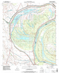
1994 Map of Somerset
USGS Topo · Published 1997About this map
The looping meanders of the Mississippi River define this 1994 snapshot of the borderlands between Louisiana and Mississippi. The landscape is dominated by the massive oxbow of Palmyra Lake and the expansive Davis Island, showing a region where water and sediment have dictated human settlement. Small communities like Somerset and Afton are positioned along the primary transport corridors, protected by an extensive Levee system that snakes along the river's edge.
Find a feature on this map
32 named features on this map. Tap any name to fly to it.
Don’t see what you’re looking for? This feature index may not catch every label — zoom into the map to look around manually.
Map Details
Editions of this 1994 Somerset Map
This is the sole edition of this map. No revisions or reprints were ever made.
Other maps of this area

1909 · Mound
USGS Topo · 1:24,000

1910 · Mound
USGS Topo · 1:31,680

1935 · Waverly
USGS Topo · 1:62,500

1935 · Shackleford Lake
USGS Topo · 1:62,500

1939 · Talla Bena
USGS Topo · 1:62,500

1955 · Jackson
USGS Topo · 1:250,000

1958 · Shackleford Lake
USGS Topo · 1:62,500

1961 · Jackson
USGS Topo · 1:250,000

1961 · Waverly
USGS Topo · 1:62,500

1962 · Jackson
USGS Topo · 1:250,000