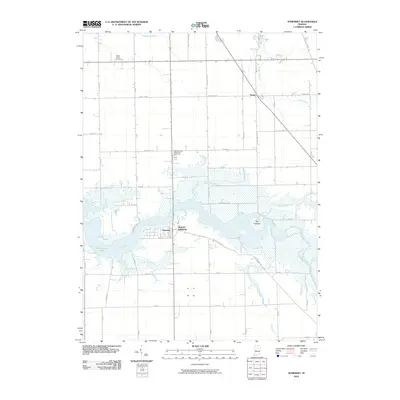
2010 Map of Somerset
USGS Topo · Published 2010About this map
Mississinewa Lake dominates the central landscape of this Wabash County region, its flooded valleys creating a complex shoreline that defines local geography. The settlement of Somerset and the neighboring area of Mount Vernon sit along the western banks, while the small community of Treaty is situated to the northeast at the junction of Treaty Pike and Wacacona Pike. The terrain is marked by the unique ridge known as The Hogback, which rises above the inundated plains of the Mississinewa River.
Find a feature on this map
49 named features on this map. Tap any name to fly to it.
Don’t see what you’re looking for? This feature index may not catch every label — zoom into the map to look around manually.
Map Details
Editions of this 2010 Somerset Map
This is the sole edition of this map. No revisions or reprints were ever made.
Other maps of this area

1950 · Lagro
USGS Topo · 1:24,000

1951 · Lagro
USGS Topo · 1:24,000

1951 · Richvalley
USGS Topo · 1:24,000

1952 · Wabash
USGS Topo · 1:24,000

1953 · La Fontaine
USGS Topo · 1:24,000

1953 · Somerset
USGS Topo · 1:24,000

1953 · Peoria
USGS Topo · 1:24,000

1953 · Muncie
USGS Topo · 1:250,000

1956 · Muncie
USGS Topo · 1:250,000

1961 · Marion
USGS Topo · 1:24,000