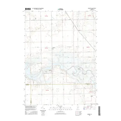
2016 Map of Somerset
USGS Topo · Published 2016About this map
Mississinewa Lake and the meandering Mississinewa River dominate the central landscape of this Wabash County region, where the town of Somerset sits at the junction of several historic routes. The terrain is marked by distinctive hydrological features such as The Hogback, a prominent ridge near the river's bend, and numerous tributaries including Tenmile Cr, Grant Creek, and Muddy Br. Small settlements like Treaty and Jalapa appear at the intersections of county roads, reflecting the agricultural and residential patterns of north-central Indiana.
Find a feature on this map
82 named features on this map. Tap any name to fly to it.
Don’t see what you’re looking for? This feature index may not catch every label — zoom into the map to look around manually.
Map Details
Editions of this 2016 Somerset Map
This is the sole edition of this map. No revisions or reprints were ever made.
Other maps of this area

1950 · Lagro
USGS Topo · 1:24,000

1951 · Lagro
USGS Topo · 1:24,000

1951 · Richvalley
USGS Topo · 1:24,000

1952 · Wabash
USGS Topo · 1:24,000

1953 · La Fontaine
USGS Topo · 1:24,000

1953 · Somerset
USGS Topo · 1:24,000

1953 · Peoria
USGS Topo · 1:24,000

1953 · Muncie
USGS Topo · 1:250,000

1956 · Muncie
USGS Topo · 1:250,000

1961 · Marion
USGS Topo · 1:24,000