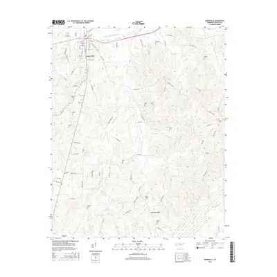
2016 Map of Somerville
USGS Topo · Published 2016About this map
Somerville, the Fayette County seat, serves as the primary hub of this West Tennessee landscape, where the town grid meets the engineered flow of the Loosahatchie River Canal. The map reveals a high density of rural burial grounds and church sites that anchor the surrounding farmland, including Smiths Chapel Cem and Mount Pisgah Cem near the smaller settlement of Pattersonville. These features, along with names like Ebenezer Cem and Asbury Cem, suggest long-standing community centers tied to the area's agricultural history. The terrain is defined by a network of drainage creeks such as Bennetts Cr and Howell Cr that feed southward toward the Wolf River bottomlands. The presence of Hawks Nest Airport in the southwest corner marks a modern transition in this largely traditional landscape of timber and row crops.
Find a feature on this map
78 named features on this map. Tap any name to fly to it.
Don’t see what you’re looking for? This feature index may not catch every label — zoom into the map to look around manually.
Map Details
Editions of this 2016 Somerville Map
This is the sole edition of this map. No revisions or reprints were ever made.
Other maps of this area

1949 · Moscow
USGS Topo · 1:62,500

1950 · Grand Junction
USGS Topo · 1:24,000

1951 · Hickory Valley
USGS Topo · 1:24,000

1951 · Grand Junction
USGS Topo · 1:24,000

1952 · Lambert
USGS Topo · 1:24,000

1952 · Laconia
USGS Topo · 1:24,000

1952 · Stanton
USGS Topo · 1:62,500

1956 · Blytheville
USGS Topo · 1:250,000

1959 · Blytheville
USGS Topo · 1:250,000

1959 · Whiteville
USGS Topo · 1:24,000