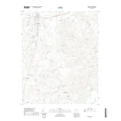
2019 Map of Somerville
USGS Topo · Published 2019About this map
Somerville stands as the primary hub of this Fayette County landscape, where the Loosahatchie River Canal cuts through the northern terrain. The area is defined by a dense network of family-named cemeteries and small settlements like Williston and Pattersonville, suggesting a deeply rooted rural community structure. To the south, the terrain descends toward the N Fork Wolf River, while various tributaries such as Bennetts Cr and Howell Cr drain the central hills. Genealogists will find a high concentration of burial sites, ranging from the central Somerville Cem to more outlying locations like Rehobeth Cem, Peebles Cem, and Smiths Chapel Cem. The inclusion of the Hawks Nest Airport near the southern boundary highlights the modern infrastructure supporting this historically agricultural region.
Find a feature on this map
83 named features on this map. Tap any name to fly to it.
Don’t see what you’re looking for? This feature index may not catch every label — zoom into the map to look around manually.
Map Details
Editions of this 2019 Somerville Map
This is the sole edition of this map. No revisions or reprints were ever made.
Other maps of this area

1949 · Moscow
USGS Topo · 1:62,500

1950 · Grand Junction
USGS Topo · 1:24,000

1951 · Hickory Valley
USGS Topo · 1:24,000

1951 · Grand Junction
USGS Topo · 1:24,000

1952 · Lambert
USGS Topo · 1:24,000

1952 · Laconia
USGS Topo · 1:24,000

1952 · Stanton
USGS Topo · 1:62,500

1956 · Blytheville
USGS Topo · 1:250,000

1959 · Blytheville
USGS Topo · 1:250,000

1959 · Whiteville
USGS Topo · 1:24,000