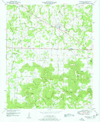
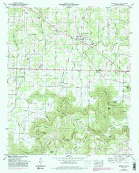
1951 Map of Somerville
USGS Topo · Published 1951About this map
Somerville serves as the central hub of this 1951 topographic study, situated at the junction of roads leading toward Turney Crossroads and Henderson. The landscape is defined by the significant rise of Brindley Mountain and Fairview Mountain to the south, where steep slopes are cut by numerous hollows such as Devils Cellar Hollow and Pannell Hollow. These topographical features created a natural boundary for early settlement, concentrating development along the flatter northern plains near Town Creek and England Creek.
Find a feature on this map
82 named features on this map. Tap any name to fly to it.
Don’t see what you’re looking for? This feature index may not catch every label — zoom into the map to look around manually.
Map Details
Editions of this 1951 Somerville Map
5 editions found
Other maps of this area

1888 · Cullman
USGS Topo · 1:125,000

1888 · Huntsville
USGS Topo · 1:125,000

1892 · Cullman
USGS Topo · 1:125,000

1892 · Huntsville
USGS Topo · 1:125,000

1927 · Falkville
USGS Topo · 1:24,000

1936 · Triana
USGS Topo · 1:24,000

1936 · Hartselle
USGS Topo · 1:24,000

1936 · Decatur
USGS Topo · 1:24,000

1936 · Eva
USGS Topo · 1:24,000

1936 · Somerville
USGS Topo · 1:24,000