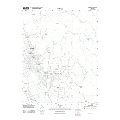
2012 Map of Sonoma
USGS Topo · Published 2012About this map
Sonoma and its neighboring wine-growing valleys are documented here at a time when traditional agricultural heritage and modern development sat side-by-side. The landscape is defined by its deep historical roots, particularly visible through the Mission San Francisco Solano Vineyard and several storied estates like Sebastiani Vineyards and Gundlach-Bundschu Winery. While the valley floor is densely clustered with communities like Boyes Hot Springs, El Verano, and Vineburg, the surrounding hillsides remain defined by steep canyons and prominent peaks such as Moon Mountain and Bismark Knob. This survey captures the intricate water network feeding the region, from the Sonoma Cr to the Arroyo Seco, alongside critical local infrastructure like the Nathanson Creek Bridge and the Sonoma Skypark. Numerous cemeteries, including the Saint Francis Solano Catholic Cem and Mountain Cem, offer specific points of interest for those researching the region's prominent families.
Find a feature on this map
138 named features on this map. Tap any name to fly to it.
Don’t see what you’re looking for? This feature index may not catch every label — zoom into the map to look around manually.
Map Details
Editions of this 2012 Sonoma Map
This is the sole edition of this map. No revisions or reprints were ever made.
Other maps of this area

1902 · Napa
USGS Topo · 1:125,000

1914 · Petaluma
USGS Topo · 1:62,500

1916 · Mare Island
USGS Topo · 1:62,500

1916 · Santa Rosa
USGS Topo · 1:62,500

1942 · Mare Island
USGS Topo · 1:62,500

1942 · Sonoma
USGS Topo · 1:62,500

1942 · Petaluma
USGS Topo · 1:62,500

1944 · Santa Rosa
USGS Topo · 1:62,500

1947 · Santa Rosa
USGS Topo · 1:250,000

1949 · Santa Rosa
USGS Topo · 1:250,000