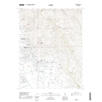
2018 Map of Sonoma
USGS Topo · Published 2018About this map
Sonoma anchors this landscape in the southern Sonoma Valley, where the grid of the historic town center gives way to surrounding vineyards and canyons. The valley floor, known here as the Sonoma Valley Valley of the Moon, is flanked by rising terrain including Moon Mtn and Mt Pisgah to the north. This survey illustrates the dense string of communities along the valley corridor, from Boyes Hot Springs and Fetters Hot Springs down through El Verano and Buena Vista. Researchers will find significant genealogical markers such as the Mountain Cem and Saint Francis Solano Catholic Cem. The map also captures the local infrastructure south of town, including the Sonoma Skypark and the junction at Four Corners, while numerous drainages like Agua Caliente Cr and Nathanson Cr define the watershed as it moves toward the marshlands beyond the southern border.
Find a feature on this map
96 named features on this map. Tap any name to fly to it.
Don’t see what you’re looking for? This feature index may not catch every label — zoom into the map to look around manually.
Map Details
Editions of this 2018 Sonoma Map
This is the sole edition of this map. No revisions or reprints were ever made.
Other maps of this area

1902 · Napa
USGS Topo · 1:125,000

1914 · Petaluma
USGS Topo · 1:62,500

1916 · Mare Island
USGS Topo · 1:62,500

1916 · Santa Rosa
USGS Topo · 1:62,500

1942 · Mare Island
USGS Topo · 1:62,500

1942 · Sonoma
USGS Topo · 1:62,500

1942 · Petaluma
USGS Topo · 1:62,500

1944 · Santa Rosa
USGS Topo · 1:62,500

1947 · Santa Rosa
USGS Topo · 1:250,000

1949 · Santa Rosa
USGS Topo · 1:250,000