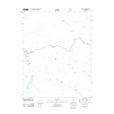
2012 Map of Sonora Pass
USGS Topo · Published 2012About this map
Kennedy Meadow and the surrounding high Sierra landscape define this 2012 survey, where the Middle Fork Stanislaus River begins its descent. The map documents the vital Sonora Pass corridor along Highway 108, a route steeped in the history of trans-Sierra travel. Recreational landmarks such as the Que De Pork Resort and Deadman Campground appear alongside significant high-elevation water bodies, including the Relief Reservoir, Kennedy Lake, and Blue Canyon Lake. The terrain is characterized by massive peaks and glacial features, from Sonora Peak in the north to Leavitt Peak in the south. Notable alpine meadows and flats like Clark Fork Meadow and Chipmunk Flat indicate the seasonal rhythms of this landscape, while named gaps such as Saint Marys Pass show the traditional pedestrian and pack routes that parallel the modern roadway.
Find a feature on this map
36 named features on this map. Tap any name to fly to it.
Don’t see what you’re looking for? This feature index may not catch every label — zoom into the map to look around manually.
Map Details
Editions of this 2012 Sonora Pass Map
This is the sole edition of this map. No revisions or reprints were ever made.
Other maps of this area

1896 · Dardanelles
USGS Topo · 1:125,000

1898 · Dardanelles
USGS Topo · 1:125,000

1948 · Walker Lake
USGS Topo · 1:250,000

1954 · Pickel Meadow
USGS Topo · 1:24,000

1954 · Lost Cannon Peak
USGS Topo · 1:24,000

1956 · Dardanelles Cone
USGS Topo · 1:62,500

1956 · Pinecrest
USGS Topo · 1:62,500

1956 · Sonora Pass
USGS Topo · 1:62,500
1956 · Tower Peak
USGS Topo · 1:62,500

1957 · Walker Lake
USGS Topo · 1:250,000