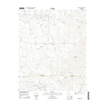
2014 Map of Sonoraville
USGS Topo · Published 2014About this map
The agricultural and rural landscape of northern Georgia unfolds across the border of Gordon and Bartow counties. This area is anchored by the small communities of Farmville, Sonoraville, and Folsom, where the road network reveals a pattern of tight-knit settlements and family-named landmarks. The terrain is defined by complex hydrology, with Pine Log Creek, Salacoa Creek, and Jacks Creek carving through the valleys.
Find a feature on this map
78 named features on this map. Tap any name to fly to it.
Don’t see what you’re looking for? This feature index may not catch every label — zoom into the map to look around manually.
Map Details
Editions of this 2014 Sonoraville Map
This is the sole edition of this map. No revisions or reprints were ever made.
Other maps of this area

1886 · Dalton
USGS Topo · 1:125,000

1890 · Cartersville
USGS Topo · 1:125,000

1891 · Cartersville
USGS Topo · 1:125,000

1892 · Dalton
USGS Topo · 1:125,000

1896 · Cartersville
USGS Topo · 1:125,000

1897 · Dalton
USGS Topo · 1:125,000

1914 · Talking Rock
USGS Topo · 1:62,500

1916 · Talking Rock
USGS Topo · 1:62,500

1941 · Adairsville
USGS Topo · 1:62,500

1944 · Adairsville
USGS Topo · 1:62,500