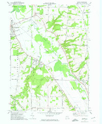
1972 Map of Sonyea
USGS Topo · Published 1974About this map
Craig State School dominates the central landscape of this 1970s survey, marking the expansive grounds of the former institution at Sonyea. The terrain is defined by the winding course of Canaseraga Creek and the historical remnants of the Canaseraga Canal, illustrating the evolution of transport in this corner of Livingston County. Rail infrastructure is prominent, with the Erie-Lackawanna and the Dansville and Mount Morris lines cutting through the valley. Rural life is anchored by small settlements like Kysorville and Tuscarora, along with numerous local burial grounds including the Craig State Sch Cem and Williamsburgh Cem. The map captures the interface between institutional land use and the agricultural valley, where old water features like the Tail Race at Shaker Crossing reflect earlier industrial efforts to harness the local waterways for power and transit.
Find a feature on this map
78 named features on this map. Tap any name to fly to it.
Don’t see what you’re looking for? This feature index may not catch every label — zoom into the map to look around manually.
Map Details
Editions of this 1972 Sonyea Map
2 editions found
Other maps of this area

1901 · Honeoye
USGS Topo · 1:62,500

1902 · Wayland
USGS Topo · 1:62,500

1904 · Wayland
USGS Topo · 1:62,500

1904 · Caledonia
USGS Topo · 1:62,500

1904 · Honeoye
USGS Topo · 1:62,500

1905 · Nunda
USGS Topo · 1:62,500

1942 · Dansville
USGS Topo · 1:31,680

1942 · Conesus
USGS Topo · 1:31,680
1942 · Livonia
USGS Topo · 1:31,680

1943 · Mount Morris
USGS Topo · 1:24,000