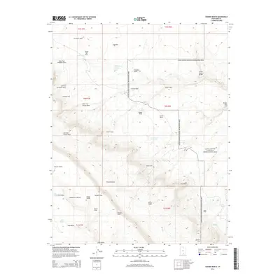
2014 Map of Sooner Bench
USGS Topo · Published 2014About this map
Straight Cliffs dominate the southwestern horizon of this landscape, marking the dramatic edge of the Kaiparowits Plateau. This high-desert region is defined by a series of massive benches and canyons within the Glen Canyon National Recreation Area. The terrain transitions from the broad expanses of Sooner Bench and Fiftymile Bench into deep erosional features like Willow Gulch and Fortymile Gulch.
Find a feature on this map
47 named features on this map. Tap any name to fly to it.
Don’t see what you’re looking for? This feature index may not catch every label — zoom into the map to look around manually.
Map Details
Editions of this 2014 Sooner Bench Map
This is the sole edition of this map. No revisions or reprints were ever made.
Other maps of this area

1886 · Escalante
USGS Topo · 1:250,000

1886 · Henry Mountains
USGS Topo · 1:250,000

1892 · Henry Mountains
USGS Topo · 1:250,000

1953 · Cummings Mesa
USGS Topo · 1:62,500

1953 · The Rincon
USGS Topo · 1:62,500

1953 · Navajo Mountain
USGS Topo · 1:62,500

1956 · Escalante
USGS Topo · 1:250,000

1960 · Escalante
USGS Topo · 1:250,000
1968 · Big Hollow Wash
USGS Topo · 1:24,000
1968 · Blackburn Canyon
USGS Topo · 1:24,000