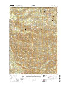
2014 Map of Soosap Peak
USGS Topo · Published 2014About this map
Mount Hood National Forest dominates this landscape, where the upper watersheds of the S Fork Clackamas River and N Fork Molalla River meet. The terrain is defined by dramatic elevation changes, notably at Soosap Peak and within the steep corridors of Dead Horse Canyon and Rock Canyon. This 2014 survey reveals a dense network of forest service roads, including Goat Mountain Rd and NF-45, which provide access to high-altitude water bodies like Williams Lake, Emerald Lake, and Cougar Lake. The presence of Timothy Patch in the northeast corner suggest a localized area of specific historical or navigational interest within the broader timberlands. Numerous tributaries such as Lukens Cr, Cougar Cr, and Pine Cr weave through the township boundaries of t5s r4e and t6s r4e, illustrating the complex drainage patterns of the Oregon Cascades.
Find a feature on this map
69 named features on this map. Tap any name to fly to it.
Don’t see what you’re looking for? This feature index may not catch every label — zoom into the map to look around manually.
Map Details
Editions of this 2014 Soosap Peak Map
This is the sole edition of this map. No revisions or reprints were ever made.
Other maps of this area

1916 · Estacada
USGS Topo · 1:125,000

1929 · Mill City
USGS Topo · 1:125,000

1948 · Vancouver
USGS Topo · 1:250,000

1950 · Vancouver
USGS Topo · 1:250,000

1950 · Vancouver
USGS Topo · 1:250,000

1953 · Salem
USGS Topo · 1:250,000

1954 · Salem
USGS Topo · 1:250,000

1955 · Colton
USGS Topo · 1:62,500
1955 · Colton
USGS Topo · 1:24,000

1955 · Mill City
USGS Topo · 1:62,500