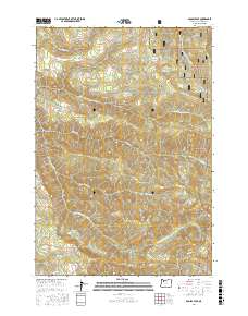
2017 Map of Soosap Peak
USGS Topo · Published 2017About this map
Soosap Peak rises above a landscape defined by deep drainages and isolated mountain lakes within the Mount Hood National Forest. This high-country terrain serves as the headwaters for several significant waterways, including the N Fork Molalla River and the S Fork Clackamas River. Small, high-elevation water bodies like Williams Lake, Emerald Lake, and Cougar Lake are scattered throughout the quadrangle, connected by an intricate network of forest service routes such as Green Mountain Rd and Timothy Patch Rd. Notable geographical depressions including Dead Horse Canyon and Rock Canyon illustrate the erosive power of Canyon Cr and its tributaries. The survey clearly delineates the administrative boundaries of t5s r4e and t6s r4e, showing the transition between these townships in a heavily forested environment used for timber management and outdoor recreation.
Find a feature on this map
39 named features on this map. Tap any name to fly to it.
Don’t see what you’re looking for? This feature index may not catch every label — zoom into the map to look around manually.
Map Details
Editions of this 2017 Soosap Peak Map
This is the sole edition of this map. No revisions or reprints were ever made.
Other maps of this area

1916 · Estacada
USGS Topo · 1:125,000

1929 · Mill City
USGS Topo · 1:125,000

1948 · Vancouver
USGS Topo · 1:250,000

1950 · Vancouver
USGS Topo · 1:250,000

1950 · Vancouver
USGS Topo · 1:250,000

1953 · Salem
USGS Topo · 1:250,000

1954 · Salem
USGS Topo · 1:250,000

1955 · Colton
USGS Topo · 1:62,500
1955 · Colton
USGS Topo · 1:24,000

1955 · Mill City
USGS Topo · 1:62,500