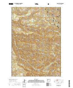
2020 Map of Soosap Peak
USGS Topo · Published 2020About this map
Mount Hood National Forest dominates this section of the Oregon Cascades, where the headwaters of the N Fork Molalla River and S Fork Clackamas River drain a series of high ridges and deep basins. The landscape is defined by its verticality, rising toward the prominent Soosap Peak and Green Mountain. For those interested in the water systems of the region, the map details the positions of high-elevation bodies like Emerald Lake, Cougar Lake, and Williams Lake. Extensive forest management is evident through the network of numbered routes such as Williams Lake Rd and Timothy Patch Rd, which provide access to remote areas like Timothy Patch and the steep terrain of Dead Horse Canyon. The intricate contouring illustrates the complex drainage patterns of Lukens Cr and Cougar Cr as they feed into the larger river systems of Clackamas County.
Find a feature on this map
36 named features on this map. Tap any name to fly to it.
Don’t see what you’re looking for? This feature index may not catch every label — zoom into the map to look around manually.
Map Details
Editions of this 2020 Soosap Peak Map
This is the sole edition of this map. No revisions or reprints were ever made.
Other maps of this area

1916 · Estacada
USGS Topo · 1:125,000

1929 · Mill City
USGS Topo · 1:125,000

1948 · Vancouver
USGS Topo · 1:250,000

1950 · Vancouver
USGS Topo · 1:250,000

1950 · Vancouver
USGS Topo · 1:250,000

1953 · Salem
USGS Topo · 1:250,000

1954 · Salem
USGS Topo · 1:250,000

1955 · Colton
USGS Topo · 1:62,500
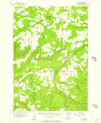
1955 · Colton
USGS Topo · 1:24,000

1955 · Mill City
USGS Topo · 1:62,500