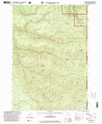
1997 Map of Soosap Peak
USGS Topo · Published 1999About this map
Soosap Peak rises as a prominent landmark within the Mt Hood National Forest, anchoring a landscape defined by the drainage systems of the Mollala River and its North Fork. This 1990s revision by the USDA Forest Service illustrates a high-elevation environment where industrial land use meets protected wilderness. Numerous labeled Quarry sites are scattered throughout the drainages of Dead Horse Canyon and Lukens Rock Creek, indicating active timber road maintenance or local resource extraction.
Find a feature on this map
22 named features on this map. Tap any name to fly to it.
Don’t see what you’re looking for? This feature index may not catch every label — zoom into the map to look around manually.
Map Details
Editions of this 1997 Soosap Peak Map
This is the sole edition of this map. No revisions or reprints were ever made.
Other maps of this area

1916 · Estacada
USGS Topo · 1:125,000

1929 · Mill City
USGS Topo · 1:125,000

1948 · Vancouver
USGS Topo · 1:250,000

1950 · Vancouver
USGS Topo · 1:250,000

1950 · Vancouver
USGS Topo · 1:250,000

1953 · Salem
USGS Topo · 1:250,000

1954 · Salem
USGS Topo · 1:250,000

1955 · Colton
USGS Topo · 1:62,500
1955 · Colton
USGS Topo · 1:24,000

1955 · Mill City
USGS Topo · 1:62,500