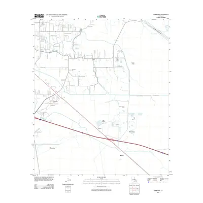
2012 Map of Sorrento
USGS Topo · Published 2012About this map
The low-lying cypress swamps and ridges of Ascension Parish are defined here by a complex network of bayous and man-made waterways. Sorrento sits at the heart of this landscape, where the local economy and geography are shaped by features like the Sorrento Gas and Oil Field and the BFI Colonial Landfill. The map illustrates a transition from the traditional settlement patterns along Bayou Francois and Bayou Conway to the engineered hydrology of the Amite River Diversion Canal and the New River Canal.
Find a feature on this map
101 named features on this map. Tap any name to fly to it.
Don’t see what you’re looking for? This feature index may not catch every label — zoom into the map to look around manually.
Map Details
Editions of this 2012 Sorrento Map
This is the sole edition of this map. No revisions or reprints were ever made.
Other maps of this area

1892 · Mount Airy
USGS Topo · 1:62,500

1892 · Donaldsonville
USGS Topo · 1:62,500

1934 · Denham Springs
USGS Topo · 1:62,500

1934 · Springfield
USGS Topo · 1:62,500

1935 · Gonzales
USGS Topo · 1:31,680

1939 · Springfield
USGS Topo · 1:62,500

1939 · Denham Springs
USGS Topo · 1:62,500

1939 · Donaldsonville
USGS Topo · 1:62,500

1946 · Convent
USGS Topo · 1:31,680
1946 · Lutcher
USGS Topo · 1:31,680