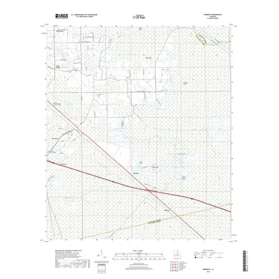
2018 Map of Sorrento
USGS Topo · Published 2018About this map
Sorrento sits at the intersection of rail and road in this part of Ascension Parish, where the low-lying landscape is defined by a dense network of water management features and historical family roads. The area transitions from the more developed corridor near the Louisiana Technical College Ascension Campus and River Parishes Community College to the swampy terrain around Lake Ridge and McElroy Ridge. Distinctive local family names are preserved in the road network, such as Kid Bourgeois Rd and Daniel Guidry Rd, reflecting the genealogy of settlements like Duckroost and Acy. The presence of the Panama Canal and various other engineered waterways like the Anderson Canal and New River Canal highlights the complex hydraulic history required to manage the wetlands between the Livingston and St. James Parish lines.
Find a feature on this map
71 named features on this map. Tap any name to fly to it.
Don’t see what you’re looking for? This feature index may not catch every label — zoom into the map to look around manually.
Map Details
Editions of this 2018 Sorrento Map
This is the sole edition of this map. No revisions or reprints were ever made.
Other maps of this area

1892 · Mount Airy
USGS Topo · 1:62,500

1892 · Donaldsonville
USGS Topo · 1:62,500

1934 · Denham Springs
USGS Topo · 1:62,500

1934 · Springfield
USGS Topo · 1:62,500

1935 · Gonzales
USGS Topo · 1:31,680

1939 · Springfield
USGS Topo · 1:62,500

1939 · Denham Springs
USGS Topo · 1:62,500

1939 · Donaldsonville
USGS Topo · 1:62,500

1946 · Convent
USGS Topo · 1:31,680
1946 · Lutcher
USGS Topo · 1:31,680