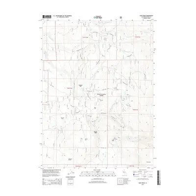
2015 Map of Soup Creek
USGS Topo · Published 2015About this map
Cantrall Mill and Brooks Mill anchor this pocket of the Modoc National Forest, representing the legacy of timber and water management in northeastern California. The landscape is defined by a complex network of forest access routes, including the Old Cantrall Mill Spur and the Bowman Ranch Spur, which reflect the historic ranching and milling operations that utilized the area's natural meadows and water sources. These open spaces, such as Bear Flat, Hacker Flat, and the expansive Flournoy Swale, provide a clear view of the traditional land-use patterns in the Warner Mountains. The map also details early water infrastructure like the Bowman Ditch, highlighting how natural flows from Soup Creek and Mill Cr were managed. From the cascading Mill Creek Falls to the high-elevation Soup Spring, the terrain illustrates a transition from productive valleys to the high Top of Ridge summits.
Find a feature on this map
44 named features on this map. Tap any name to fly to it.
Don’t see what you’re looking for? This feature index may not catch every label — zoom into the map to look around manually.
Map Details
Editions of this 2015 Soup Creek Map
This is the sole edition of this map. No revisions or reprints were ever made.
Other maps of this area

1886 · Alturas
USGS Topo · 1:250,000

1892 · Alturas
USGS Topo · 1:250,000

1954 · Alturas
USGS Topo · 1:250,000

1958 · Alturas
USGS Topo · 1:250,000

1962 · Alturas
USGS Topo · 1:250,000

1962 · Tule Mountain
USGS Topo · 1:24,000

1962 · Jess Valley
USGS Topo · 1:24,000
1962 · Emerson Peak
USGS Topo · 1:24,000

1963 · Warren Peak
USGS Topo · 1:24,000

1963 · Little Juniper Reservoir
USGS Topo · 1:24,000