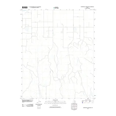
2010 Map of Sourdough Creek SW
USGS Topo · Published 2010About this map
The rolling plains of Ochiltree County are defined by a network of drainage systems and rural transit routes in this northern Texas Panhandle study. The terrain is notably marked by the southward-flowing Jocks Creek, which carves a dendritic path across the landscape, eventually joined in the southeast by West Dugout Creek. This era of the landscape is characterized by a precise grid of county roads that facilitate the region's agricultural and energy-related movement. Significant thoroughfares like Fm 281 and Co Rd Bb anchor the northern section, while family-named routes such as McGarraugh Rd and Wilson Rd provide critical access to the more dissected creek bottoms. The map reveals the rural infrastructure of the 21st-century High Plains, where the intersection of natural watercourses and man-made county lines dictates the layout of the land.
Find a feature on this map
11 named features on this map. Tap any name to fly to it.
Don’t see what you’re looking for? This feature index may not catch every label — zoom into the map to look around manually.
Map Details
Editions of this 2010 Sourdough Creek SW Map
This is the sole edition of this map. No revisions or reprints were ever made.
Other maps of this area

1954 · Perryton
USGS Topo · 1:250,000

1954 · Amarillo
USGS Topo · 1:250,000

1958 · Perryton
USGS Topo · 1:250,000

1958 · Amarillo
USGS Topo · 1:250,000

1971 · Dry Creek NE
USGS Topo · 1:24,000

1971 · Dry Creek North
USGS Topo · 1:24,000

1971 · Garden Springs
USGS Topo · 1:24,000

1973 · Sourdough Creek NE
USGS Topo · 1:24,000

1973 · Sourdough Creek SW
USGS Topo · 1:24,000

1973 · Spearman NE
USGS Topo · 1:24,000