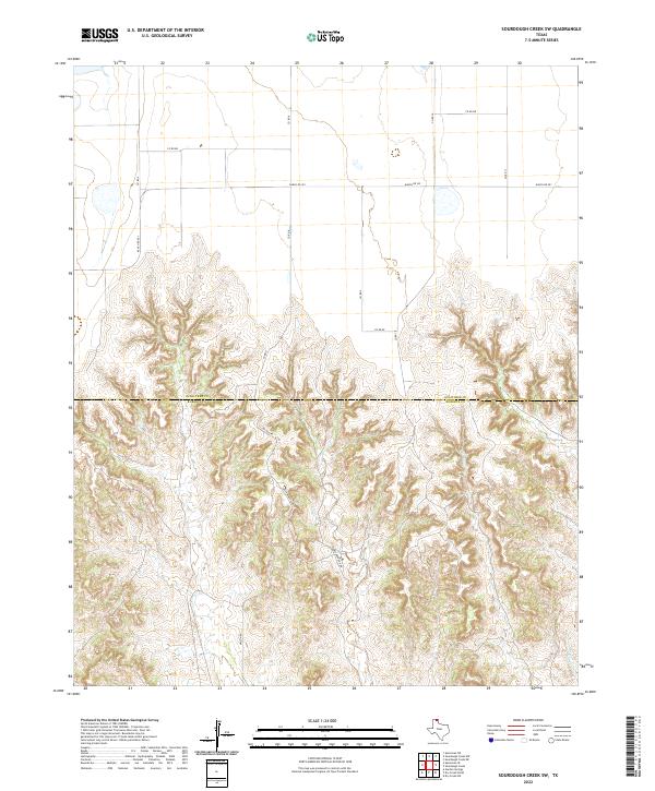
2022 Map of Sourdough Creek SW
USGS Topo · Published 2022About this map
Deeply incised canyons and drainage networks define this part of the Texas Panhandle, where the high plains break away into complex topography along the Ochiltree Co and Roberts Co line. Unlike the flat agricultural sections of the county, this area is dominated by the erosion patterns of W Dugout Cr and Parks Cr, creating a landscape that dictates the path of local infrastructure. Transportation through these breaks is confined to specific ridges and valleys, with Mcgarraugh Rd and Wilson Rd winding through the terrain to connect remote ranching operations to the primary artery of Ranch Rd 281. The map reveals a transition from the rectangular grid of the upper plains, seen in routes like Co Rd BB, to the irregular, landform-following roads required by the southern canyonlands.
Find a feature on this map
13 named features on this map. Tap any name to fly to it.
Don’t see what you’re looking for? This feature index may not catch every label — zoom into the map to look around manually.
Map Details
Editions of this 2022 Sourdough Creek SW Map
This is the sole edition of this map. No revisions or reprints were ever made.
Other maps of this area

1954 · Perryton
USGS Topo · 1:250,000

1954 · Amarillo
USGS Topo · 1:250,000

1958 · Perryton
USGS Topo · 1:250,000

1958 · Amarillo
USGS Topo · 1:250,000

1971 · Dry Creek NE
USGS Topo · 1:24,000

1971 · Dry Creek North
USGS Topo · 1:24,000

1971 · Garden Springs
USGS Topo · 1:24,000

1973 · Sourdough Creek NE
USGS Topo · 1:24,000

1973 · Sourdough Creek SW
USGS Topo · 1:24,000

1973 · Spearman NE
USGS Topo · 1:24,000