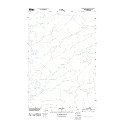
2011 Map of Sourdough School
USGS Topo · Published 2011About this map
Sweet Grass Creek and its many tributaries carve through this section of Sweet Grass County, defining the drainage patterns of the Montana landscape as it appeared in the early 21st century. The map reveals a network of watercourses, including Dry Fork Sweet Grass Creek and the East Fork Sweet Grass Creek, which converge to support the local ranching and agricultural environment. A notable landmark in the central portion of the quadrangle is the Gods Country Number 1 Dam, which manages the flow along the Dry Fork. The human imprint on this area is primarily represented by rural access roads such as Gibson Rd, Howie Rd, and the curiously named Harms Way, connecting remote homesteads and grazing lands across the varied terrain of Sourdough Creek and Wildcat Creek.
Find a feature on this map
14 named features on this map. Tap any name to fly to it.
Don’t see what you’re looking for? This feature index may not catch every label — zoom into the map to look around manually.
Map Details
Editions of this 2011 Sourdough School Map
This is the sole edition of this map. No revisions or reprints were ever made.
Other maps of this area

1889 · Big Snowy Mountain
USGS Topo · 1:250,000

1891 · Big Timber
USGS Topo · 1:125,000

1893 · Big Snowy Mountain
USGS Topo · 1:250,000

1893 · Big Timber
USGS Topo · 1:125,000
1954 · Ryan Creek
USGS Topo · 1:24,000

1954 · Billings
USGS Topo · 1:250,000

1954 · Roundup
USGS Topo · 1:250,000

1955 · Greycliff
USGS Topo · 1:24,000

1955 · Stephens Hill
USGS Topo · 1:24,000

1957 · Billings
USGS Topo · 1:250,000