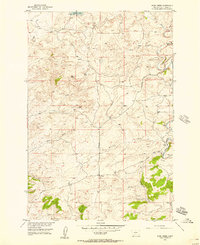
1954 Map of Ryan Creek
USGS Topo · Published 1957About this map
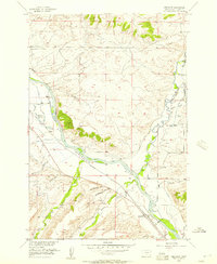
Sweet Grass County ranching lands and coulees define this mid-century landscape, mapped as part of the Department of the Interior program for the development of the Missouri River Basin. The topography is characterized by a complex network of draws and creeks, including Tangen Draw in the northwest and Nash Gulch cutting across the central hills. Human activity is marked by scattered infrastructure like the Wulff Ranch and a trio of named thoroughfares: Sourdough Road, Gibson Road, and Howie Road.
Find a feature on this map
16 named features on this map. Tap any name to fly to it.
Don’t see what you’re looking for? This feature index may not catch every label — zoom into the map to look around manually.
Map Details
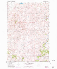
Editions of this 1954 Ryan Creek Map
2 editions found
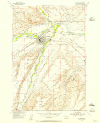
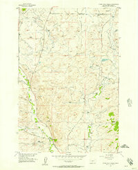
Other maps of this area

1889 · Big Snowy Mountain
USGS Topo · 1:250,000

1891 · Big Timber
USGS Topo · 1:125,000

1893 · Big Snowy Mountain
USGS Topo · 1:250,000

1893 · Big Timber
USGS Topo · 1:125,000
1954 · Big Timber
USGS Topo · 1:24,000
1954 · Otter Creek School
USGS Topo · 1:24,000

1954 · Billings
USGS Topo · 1:250,000

1954 · Roundup
USGS Topo · 1:250,000
1955 · Greycliff
USGS Topo · 1:24,000

1957 · Billings
USGS Topo · 1:250,000