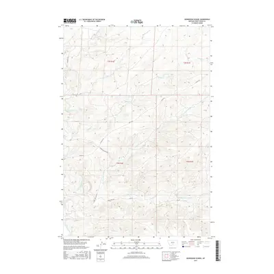
2017 Map of Sourdough School
USGS Topo · Published 2017About this map
Sourdough Sch stands as a focal point in this rural Sweet Grass County landscape, where the high plains of Montana meet a complex network of seasonal and perennial drainages. The area is defined by the significant branching of Sweet Grass Creek, which is fed by various tributaries including Dry Fork Sweet Grass Cr, E Fork Sweet Grass Cr, and Sams Cr. This hydrologic pattern suggests a ranching-driven economy, supported by a grid of local transport routes like Rapelje Rd and Tin Can Hill Rd.
Find a feature on this map
19 named features on this map. Tap any name to fly to it.
Don’t see what you’re looking for? This feature index may not catch every label — zoom into the map to look around manually.
Map Details
Editions of this 2017 Sourdough School Map
This is the sole edition of this map. No revisions or reprints were ever made.
Other maps of this area

1889 · Big Snowy Mountain
USGS Topo · 1:250,000

1891 · Big Timber
USGS Topo · 1:125,000

1893 · Big Snowy Mountain
USGS Topo · 1:250,000

1893 · Big Timber
USGS Topo · 1:125,000
1954 · Ryan Creek
USGS Topo · 1:24,000

1954 · Billings
USGS Topo · 1:250,000

1954 · Roundup
USGS Topo · 1:250,000

1955 · Greycliff
USGS Topo · 1:24,000

1955 · Stephens Hill
USGS Topo · 1:24,000

1957 · Billings
USGS Topo · 1:250,000