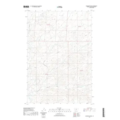
2020 Map of Sourdough School
USGS Topo · Published 2020About this map
Sweet Grass Creek and its numerous tributaries dominate this landscape in Sweet Grass County. This 2020 survey illustrates a complex network of drainage systems including Sourdough Cr, Wildcat Cr, and Sixshooter Cr that carve through the local topography. The presence of Boggs Ditch indicates the management of water resources in this ranching country, where roads like Rapelje Rd and Tin Can Hill Rd navigate the contours of the land. The mapping of Dry Fork Sweet Grass Cr and the E Fork Sweet Grass Cr highlights the intricate hydrology of the region. This modern topographic study provides an exact record of the area's rural road network, from Lower Sweet Grass Rd to Lower East Fork Rd, reflecting the sparse but enduring settlement patterns of central Montana.
Find a feature on this map
19 named features on this map. Tap any name to fly to it.
Don’t see what you’re looking for? This feature index may not catch every label — zoom into the map to look around manually.
Map Details
Editions of this 2020 Sourdough School Map
This is the sole edition of this map. No revisions or reprints were ever made.
Other maps of this area

1889 · Big Snowy Mountain
USGS Topo · 1:250,000

1891 · Big Timber
USGS Topo · 1:125,000

1893 · Big Snowy Mountain
USGS Topo · 1:250,000

1893 · Big Timber
USGS Topo · 1:125,000
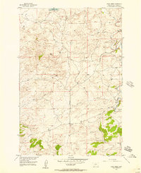
1954 · Ryan Creek
USGS Topo · 1:24,000

1954 · Billings
USGS Topo · 1:250,000

1954 · Roundup
USGS Topo · 1:250,000

1955 · Greycliff
USGS Topo · 1:24,000

1955 · Stephens Hill
USGS Topo · 1:24,000

1957 · Billings
USGS Topo · 1:250,000