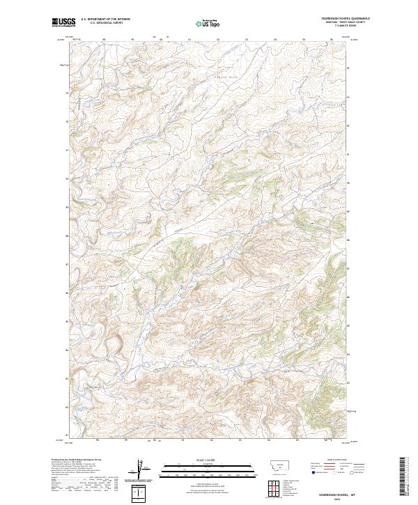
2024 Map of Sourdough School
USGS Topo · Published 2024About this map
The Cayuse Hills rise above a complex network of drainages in this ranching-dominated landscape of Sweet Grass County. The map captures the significant hydrological infrastructure of the High Plains, including the Baggs Ditch irrigation system and the winding paths of Sweet Grass Creek and its major tributaries. This 2024 survey documents the enduring pastoral character of the region, where the land is carved by the Dry Fork Sweet Grass Creek and East Fork Sweet Grass Creek. Transportation across this expansive terrain relies on established routes such as Rapelje Rd, Tin Can Hill Rd, and Sourdough Rd, which connect the scattered homesteads and ranches. The cartography provides a clear view of the Public Land Survey System grids, specifically marking sections within t3n r16e and t2n r17e.
Find a feature on this map
20 named features on this map. Tap any name to fly to it.
Don’t see what you’re looking for? This feature index may not catch every label — zoom into the map to look around manually.
Map Details
Editions of this 2024 Sourdough School Map
This is the sole edition of this map. No revisions or reprints were ever made.
Other maps of this area

1889 · Big Snowy Mountain
USGS Topo · 1:250,000

1891 · Big Timber
USGS Topo · 1:125,000

1893 · Big Snowy Mountain
USGS Topo · 1:250,000

1893 · Big Timber
USGS Topo · 1:125,000
1954 · Ryan Creek
USGS Topo · 1:24,000

1954 · Billings
USGS Topo · 1:250,000

1954 · Roundup
USGS Topo · 1:250,000

1955 · Greycliff
USGS Topo · 1:24,000

1955 · Stephens Hill
USGS Topo · 1:24,000

1957 · Billings
USGS Topo · 1:250,000