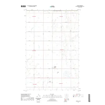
2020 Map of Souris
USGS Topo · Published 2020About this map
The town of Souris serves as the focal point of this Bottineau County landscape, situated where the grid of agricultural roads meets the meandering path of Boundary Cr. This 2020 survey reveals a community deeply rooted in its local geography, with Railroad Ave tracing the town's historical connection to rail transport. The surrounding prairie is dotted with numerous small wetlands and sloughs, characteristic of the region's glacial topography near the international border with the United States of America. Genealogy and local history researchers can identify specific family and community sites, such as Bethesda Cem to the northeast and Mountain View Cem just south of the town center. The presence of the Kornkven Airstrip further south highlights the area's ongoing reliance on aviation for transport and agricultural operations in this part of North Dakota.
Find a feature on this map
29 named features on this map. Tap any name to fly to it.
Don’t see what you’re looking for? This feature index may not catch every label — zoom into the map to look around manually.
Map Details
Editions of this 2020 Souris Map
This is the sole edition of this map. No revisions or reprints were ever made.
Other maps of this area

1954 · Souris SW
USGS Topo · 1:24,000

1954 · Landa SE
USGS Topo · 1:24,000

1954 · Souris
USGS Topo · 1:24,000

1954 · Souris SE
USGS Topo · 1:24,000

1954 · Roth
USGS Topo · 1:24,000

1954 · Minot
USGS Topo · 1:250,000

1956 · Carbury
USGS Topo · 1:24,000

1958 · Minot
USGS Topo · 1:250,000

1980 · Bottineau
USGS Topo · 1:100,000
2011 · Carbury
USGS Topo · 1:24,000