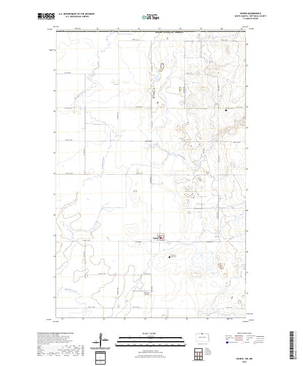
2024 Map of Souris
USGS Topo · Published 2024About this map
Souris sits at the heart of this Bottineau County landscape, a community defined by its proximity to the international border with the United States of America. The terrain is characterized by the winding path of Boundary Creek, which meanders across the prairie, reflecting the agricultural and topographical patterns of the North Dakota plains. The map reveals a systematic grid of section lines and local roads, such as Co Rd 6 NE and 1st Ave NE, that organize the rural space around the central settlement. Local history is anchored by the presence of Bethesda Cem and Mountain View Cem, which provide genealogical touchpoints for the area. The inclusion of the Kornkven Airstrip south of town indicates the ongoing importance of local aviation in this expansive agricultural region, while the various township and range lines, including t163n r77w, provide the precise geographic framework used for land ownership and surveying.
Find a feature on this map
33 named features on this map. Tap any name to fly to it.
Don’t see what you’re looking for? This feature index may not catch every label — zoom into the map to look around manually.
Map Details
Editions of this 2024 Souris Map
This is the sole edition of this map. No revisions or reprints were ever made.
Other maps of this area

1954 · Souris SW
USGS Topo · 1:24,000

1954 · Landa SE
USGS Topo · 1:24,000

1954 · Souris
USGS Topo · 1:24,000

1954 · Souris SE
USGS Topo · 1:24,000

1954 · Roth
USGS Topo · 1:24,000

1954 · Minot
USGS Topo · 1:250,000

1956 · Carbury
USGS Topo · 1:24,000

1958 · Minot
USGS Topo · 1:250,000

1980 · Bottineau
USGS Topo · 1:100,000
2011 · Carbury
USGS Topo · 1:24,000