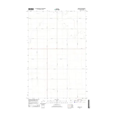
2014 Map of Souris SW
USGS Topo · Published 2014About this map
Boundary Cr meanders across the northern reaches of this rural Bottineau County landscape, providing the primary hydrological relief in an area defined by a rigorous section-line road grid. The intersection of Nd-5 and Nd-14 serves as the central transit point for the region, where state highways meet local thoroughfares like Central Ave and Cr-37. This 2014 survey illustrates the persistence of the Public Land Survey System, with gravel and paved routes such as 96th St NW and 3rd Ave Ne marking out the agricultural blocks typical of the North Dakota plains. The map reflects a landscape of broad utility, showing the systematic naming of rural roads that support the local farming economy near the Canadian border.
Find a feature on this map
22 named features on this map. Tap any name to fly to it.
Don’t see what you’re looking for? This feature index may not catch every label — zoom into the map to look around manually.
Map Details
Editions of this 2014 Souris SW Map
This is the sole edition of this map. No revisions or reprints were ever made.
Other maps of this area

1949 · Kramer
USGS Topo · 1:24,000

1950 · Kramer
USGS Topo · 1:24,000

1950 · Deep
USGS Topo · 1:24,000

1954 · Souris SW
USGS Topo · 1:24,000

1954 · Landa SE
USGS Topo · 1:24,000

1954 · Souris
USGS Topo · 1:24,000

1954 · Souris SE
USGS Topo · 1:24,000

1954 · Roth
USGS Topo · 1:24,000

1954 · Minot
USGS Topo · 1:250,000
1955 · Upham NE
USGS Topo · 1:24,000