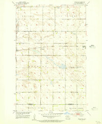
1955 Map of Upham NE
USGS Topo · Published 1956About this map
Gardena sits as a primary rail hub in the mid-1950s, serving the agricultural needs of the North Dakota prairie along the Minneapolis St Paul and Sault Ste Marie line. This survey, part of the development program for the Missouri River Basin, captures the landscape at a point of transition, noting a School No 1 (Abandoned) east of the main town site.
Find a feature on this map
11 named features on this map. Tap any name to fly to it.
Don’t see what you’re looking for? This feature index may not catch every label — zoom into the map to look around manually.
Map Details
Editions of this 1955 Upham NE Map
This is the sole edition of this map. No revisions or reprints were ever made.
Other maps of this area

1949 · Kramer
USGS Topo · 1:24,000

1950 · Kramer
USGS Topo · 1:24,000

1950 · Upham SE
USGS Topo · 1:24,000

1950 · Upham
USGS Topo · 1:24,000

1950 · Willow City SW
USGS Topo · 1:24,000

1954 · Souris SW
USGS Topo · 1:24,000

1954 · Souris SE
USGS Topo · 1:24,000

1954 · Gardena
USGS Topo · 1:24,000

1954 · Minot
USGS Topo · 1:250,000

1955 · Bottineau
USGS Topo · 1:24,000