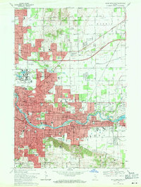
1969 Map of South Bend East
USGS Topo · Published 1971About this map
The St Joseph River anchors this 1969 survey, winding through the industrial and academic heart of South Bend and Mishawaka. The landscape is dominated by institutional landmarks, most notably the University of Notre Dame with its Stadium and St Marys Lake, alongside the developing Indiana University South Bend campus. Residential growth is evident in suburban pockets like Swanson Highlands and Indian Village, while the Indiana East-West Toll Road cuts a modern path across the northern terrain.
Find a feature on this map
118 named features on this map. Tap any name to fly to it.
Don’t see what you’re looking for? This feature index may not catch every label — zoom into the map to look around manually.
Map Details
Editions of this 1969 South Bend East Map
4 editions found
Other maps of this area

1927 · Niles
USGS Topo · 1:62,500

1930 · Niles
USGS Topo · 1:62,500

1943 · Niles
USGS Topo · 1:62,500

1945 · Cassopolis
USGS Topo · 1:62,500

1947 · Cassopolis
USGS Topo · 1:62,500

1953 · Chicago
USGS Topo · 1:250,000

1957 · Chicago
USGS Topo · 1:250,000

1958 · South Bend East
USGS Topo · 1:24,000

1958 · South Bend West
USGS Topo · 1:24,000

1958 · Osceola
USGS Topo · 1:24,000