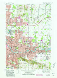
1969 Map of South Bend East
USGS Topo · Published 1981About this map
The University of Notre Dame dominates the landscape north of the St Joseph River in this detailed 1969 survey, showing the campus alongside St Josephs Lake and St Marys Lake. The map captures the suburban expansion of South Bend and Mishawaka during the late 1960s, with residential developments like Swanson Highlands and Indian Village appearing alongside established landmarks like Notre Dame Stadium. The geography is defined by the sweeping curve of the river and the older agricultural character of Harris Prairie to the north, where the Harris Prairie Cem and Harris Prairie itself remain distinct from the encroaching urban grid.
Find a feature on this map
74 named features on this map. Tap any name to fly to it.
Don’t see what you’re looking for? This feature index may not catch every label — zoom into the map to look around manually.
Map Details
Editions of this 1969 South Bend East Map
4 editions found
Other maps of this area

1927 · Niles
USGS Topo · 1:62,500

1930 · Niles
USGS Topo · 1:62,500

1943 · Niles
USGS Topo · 1:62,500

1945 · Cassopolis
USGS Topo · 1:62,500

1947 · Cassopolis
USGS Topo · 1:62,500

1953 · Chicago
USGS Topo · 1:250,000

1957 · Chicago
USGS Topo · 1:250,000

1958 · South Bend East
USGS Topo · 1:24,000

1958 · South Bend West
USGS Topo · 1:24,000

1958 · Osceola
USGS Topo · 1:24,000