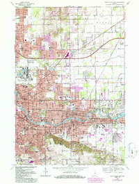
1969 Map of South Bend East
USGS Topo · Published 1986About this map
The St Joseph River winds through the heart of this urban and educational corridor, anchoring the growing cities of South Bend and Mishawaka. The landscape is defined by its massive institutional footprints, most notably the University of Notre Dame with the Notre Dame Stadium and nearby St Marys Academy. To the north, residential expansion is visible in Indian Village and Roseland, while industrial and transit networks like the Grand Trunk Western Railroad and Conrail lines intersect the grid. Beyond the city center, the survey captures significant local history sites such as Harris Prairie Cem and the St Joseph Valley Memorial Park, alongside the wooded grounds of St Francis Convent. The map reflects a mid-century period of suburban infill, where former farmlands in Clay and Harris townships transition into residential neighborhoods and school districts.
Find a feature on this map
68 named features on this map. Tap any name to fly to it.
Don’t see what you’re looking for? This feature index may not catch every label — zoom into the map to look around manually.
Map Details
Editions of this 1969 South Bend East Map
4 editions found
Other maps of this area

1927 · Niles
USGS Topo · 1:62,500

1930 · Niles
USGS Topo · 1:62,500

1943 · Niles
USGS Topo · 1:62,500

1945 · Cassopolis
USGS Topo · 1:62,500

1947 · Cassopolis
USGS Topo · 1:62,500

1953 · Chicago
USGS Topo · 1:250,000

1957 · Chicago
USGS Topo · 1:250,000

1958 · South Bend East
USGS Topo · 1:24,000

1958 · South Bend West
USGS Topo · 1:24,000

1958 · Osceola
USGS Topo · 1:24,000