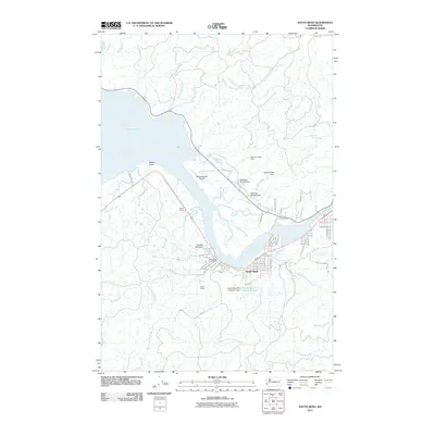
2011 Map of South Bend
USGS Topo · Published 2011About this map
South Bend sits at the dramatic meeting of the Willapa River and the expansive Willapa Bay, defined by a complex network of tidal waterways and industrial markers. The town’s layout follows the river's curve, featuring the South Bend Post Office and nearby infrastructure like the Old Mill Pond Dam and South Bend City Reservoir. These features, alongside the Milne Quarry and Willapa Harbor Airport, suggest a landscape historically tied to timber, logistics, and resource extraction.
Find a feature on this map
67 named features on this map. Tap any name to fly to it.
Don’t see what you’re looking for? This feature index may not catch every label — zoom into the map to look around manually.
Map Details
Editions of this 2011 South Bend Map
This is the sole edition of this map. No revisions or reprints were ever made.
Other maps of this area

1938 · South Bend
USGS Topo · 1:62,500

1940 · Montesano
USGS Topo · 1:62,500

1940 · South Bend
USGS Topo · 1:62,500

1953 · Hoquiam
USGS Topo · 1:250,000

1955 · Montesano
USGS Topo · 1:62,500

1955 · Raymond
USGS Topo · 1:62,500
1955 · North Nemah
USGS Topo · 1:24,000

1955 · Aberdeen SE
USGS Topo · 1:24,000

1956 · Western
USGS Topo · 1:24,000

1957 · Hoquiam
USGS Topo · 1:250,000