
1968 Map of South Branch
USGS Topo · Published 1971About this map
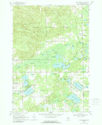
The Maltby Hills and the extensive Maltby Swamp dominate this northern Michigan landscape, where the public lands of the Huron National Forest and Ogemaw State Forest meet. The settlement of South Branch serves as a local hub near the Ogemaw and Iosco county line, supported by the small Timbers-Sky Ranch Airfield and the Oak Grove Cemetery. This late-1960s survey illustrates a region defined by its complex glacial hydrology, featuring a dense concentration of water bodies including Au Sable Lake, North Dease Lake, and the source waters of the South Branch Au Sable River. Along the western edge, the Rifle River State Recreation Area encompasses Rifle Lake and George Lake, with the seasonal community of Shady Shores providing a glimpse into the area's mid-century recreational development.
Find a feature on this map
57 named features on this map. Tap any name to fly to it.
Don’t see what you’re looking for? This feature index may not catch every label — zoom into the map to look around manually.
Map Details
Editions of this 1968 South Branch Map
2 editions found
Other maps of this area

1954 · Traverse City
USGS Topo · 1:250,000

1954 · Tawas City
USGS Topo · 1:250,000

1958 · Traverse City
USGS Topo · 1:250,000

1958 · Tawas City
USGS Topo · 1:250,000

1965 · Selkirk
USGS Topo · 1:24,000

1965 · Rose City
USGS Topo · 1:24,000

1968 · Hale
USGS Topo · 1:24,000

1968 · Sage Lake
USGS Topo · 1:24,000

1968 · Hale SE
USGS Topo · 1:24,000

1972 · Goodar
USGS Topo · 1:24,000