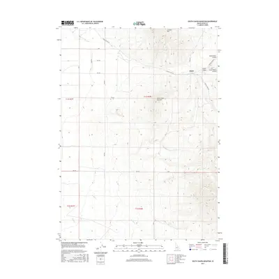
2017 Map of South Chapin Mountain
USGS Topo · Published 2017About this map
Heglar sits at the northern end of a high-elevation landscape where the canyons and ridges of Cassia County dominate the geography. This 2017 survey details the complex drainages of North Heglar Canyon, Heglar Canyon, and South Heglar Canyon as they descend from the heights of N Chapin Mtn and South Chapin Mountain. The map illustrates a strictly organized grid of rural routes such as Heglar Canyon Rd and 3300 E Rd that navigate the high country.
Find a feature on this map
26 named features on this map. Tap any name to fly to it.
Don’t see what you’re looking for? This feature index may not catch every label — zoom into the map to look around manually.
Map Details
Editions of this 2017 South Chapin Mountain Map
This is the sole edition of this map. No revisions or reprints were ever made.
Other maps of this area

1954 · Pocatello
USGS Topo · 1:250,000

1958 · Pocatello
USGS Topo · 1:250,000

1958 · Sublett
USGS Topo · 1:62,500

1959 · Lake Walcott
USGS Topo · 1:62,500

1959 · Yale
USGS Topo · 1:62,500

1968 · Malta NE
USGS Topo · 1:24,000

1968 · Malta
USGS Topo · 1:24,000

1984 · North Chapin Mountain
USGS Topo · 1:24,000
1984 · Badger Peak
USGS Topo · 1:24,000
1984 · Lake Walcott SE
USGS Topo · 1:24,000