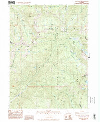
1986 Map of South China Mtn.
USGS Topo · Published 1986About this map
The Eddys and the Scott Mountains dominate this high-elevation landscape along the border of Klamath National Forest and Shasta National Forest. The 1980s terrain is defined by rugged peaks like South China Mtn and Cory Peak, which are accessible via the high-altitude High Camp Pass and Chilcoot Pass. This map captures a significant stretch of the Pacific Crest National Scenic Trail as it traverses the ridges, providing a detailed record of backcountry access in the mid-1980s.
Find a feature on this map
48 named features on this map. Tap any name to fly to it.
Don’t see what you’re looking for? This feature index may not catch every label — zoom into the map to look around manually.
Map Details
Editions of this 1986 South China Mtn. Map
This is the sole edition of this map. No revisions or reprints were ever made.
Other maps of this area

1886 · Shasta
USGS Topo · 1:250,000

1894 · Shasta
USGS Topo · 1:250,000

1923 · Sawyers Bar
USGS Topo · 1:125,000

1931 · Etna
USGS Topo · 1:96,000

1934 · Etna
USGS Topo · 1:125,000

1935 · Dunsmuir
USGS Topo · 1:125,000

1948 · Weed
USGS Topo · 1:250,000

1950 · Weed
USGS Topo · 1:250,000

1954 · Weed
USGS Topo · 1:62,500

1954 · Dunsmuir
USGS Topo · 1:62,500