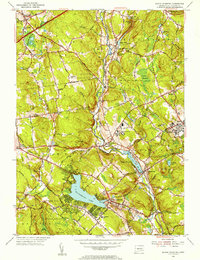
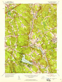
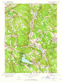
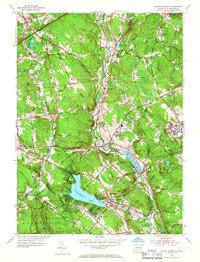
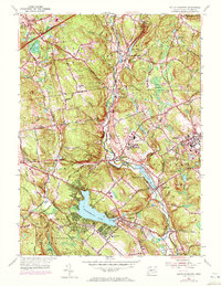
1953 Map of South Coventry
USGS Topo · Published 1955About this map
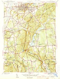
Wangumbaug Lake and the Willimantic River define the valley landscape of this mid-century Connecticut survey, where small villages and institutional grounds were connected by the Central Vermont Railway. The map captures a period of growth for the University of Connecticut in Storrs, while preserving the historic character of the surrounding countryside. Deeply rooted in Revolutionary-era history, the area includes the Nathan Hale Birthplace and the Nathan Hale State Forest south of South Coventry. Small settlements like Mansfield Depot, Merrow, and Eagleville are clearly delineated along the rail line and riverbanks. Genealogists will find notable details in the location of the Nathan Hale Cem and Tolland Cem, along with the distribution of local landmarks such as the Robertson Sch and the State Hospital near Mansfield.
Find a feature on this map
78 named features on this map. Tap any name to fly to it.
Don’t see what you’re looking for? This feature index may not catch every label — zoom into the map to look around manually.
Map Details
Editions of this 1953 South Coventry Map
5 editions found
Other maps of this area

1892 · Woodstock
USGS Topo · 1:62,500

1892 · Tolland
USGS Topo · 1:62,500

1892 · Norwich
USGS Topo · 1:62,500

1892 · Gilead
USGS Topo · 1:62,500

1921 · Tolland
USGS Topo · 1:62,500

1921 · Woodstock
USGS Topo · 1:62,500
1944 · Marlboro
USGS Topo · 1:31,680
1944 · South Coventry
USGS Topo · 1:31,680
1944 · Columbia
USGS Topo · 1:31,680
1944 · Rockville
USGS Topo · 1:31,680