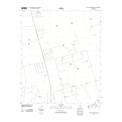
2010 Map of South Cowden Ranch
USGS Topo · Published 2010About this map
South Cowden Ranch and its surrounding Permian Basin landscape are defined by an intricate network of energy production and ranching infrastructure. This area of West Texas shows a transition from traditional livestock management to extensive petroleum extraction, evidenced by the proximity of the Virey Oil Field, Moose Oil Field, and Concho Bluff North Oil Field to scattered livestock landmarks. A high density of named water-pumping sites, including the McElroy Trap Windmill, Double Well Windmill, and the colorfully named Hillbilly Windmill, reveals the critical role of groundwater in this arid terrain. Residential and service roads like Summerstar Rd and S Snow Moon Ave branch off from S Highway 385 State Rte, while the Railway Ranch occupies the southeastern corner near the rail line.
Find a feature on this map
37 named features on this map. Tap any name to fly to it.
Don’t see what you’re looking for? This feature index may not catch every label — zoom into the map to look around manually.
Map Details
Editions of this 2010 South Cowden Ranch Map
This is the sole edition of this map. No revisions or reprints were ever made.
Other maps of this area

1954 · Pecos
USGS Topo · 1:250,000

1957 · Pecos
USGS Topo · 1:250,000

1964 · Odessa SW
USGS Topo · 1:24,000

1964 · Odessa SE
USGS Topo · 1:24,000

1964 · Doodle Bug Well
USGS Topo · 1:24,000

1964 · Parks
USGS Topo · 1:24,000

1964 · Clark Brothers Ranch
USGS Topo · 1:24,000

1964 · Perkins Lake
USGS Topo · 1:24,000

1965 · South Cowden Ranch
USGS Topo · 1:24,000

1968 · Benge Corner NW
USGS Topo · 1:24,000