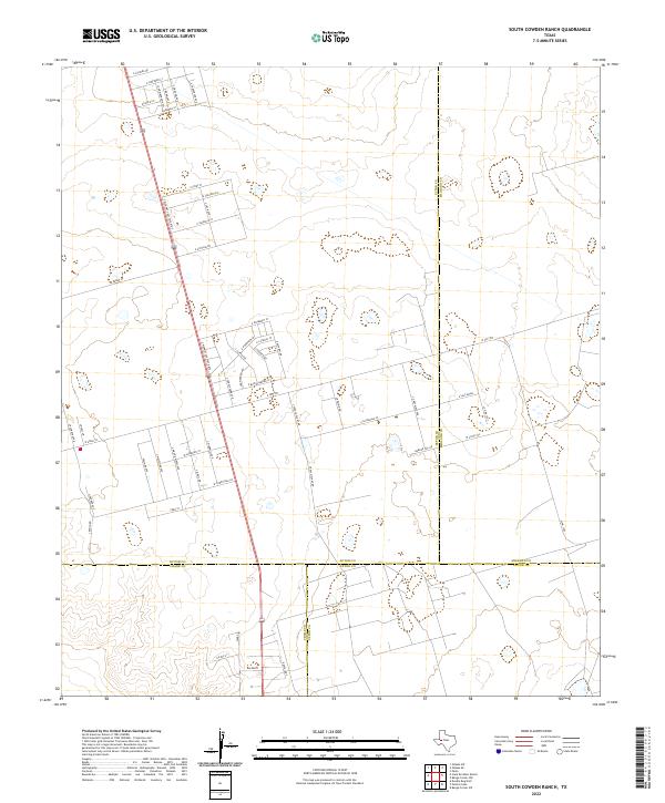
2022 Map of South Cowden Ranch
USGS Topo · Published 2022About this map
The Permian Basin oil and gas landscape of West Texas is documented here at the convergence of four counties: Ector, Crane, Upton, and Midland. Industrial infrastructure dominates the region, with the presence of S Texaco Plant Rd indicating the heavy reliance on energy extraction in this part of the state. The settlement of Michelle serves as a residential outpost in an area primarily defined by grid-like access roads and pipelines. A complex network of local routes, such as E Saltgrass St, Snow Moon, and E Blue Diamond St, provides access to the numerous well sites and facilities that dot the landscape. The primary north-south artery, S Highway 385 State Rte E, connects this industrial hub to larger regional centers, while E FM 1787 and W FM 1787 provide critical east-west mobility across the county lines.
Find a feature on this map
57 named features on this map. Tap any name to fly to it.
Don’t see what you’re looking for? This feature index may not catch every label — zoom into the map to look around manually.
Map Details
Editions of this 2022 South Cowden Ranch Map
This is the sole edition of this map. No revisions or reprints were ever made.
Other maps of this area

1954 · Pecos
USGS Topo · 1:250,000

1957 · Pecos
USGS Topo · 1:250,000

1964 · Odessa SW
USGS Topo · 1:24,000

1964 · Odessa SE
USGS Topo · 1:24,000

1964 · Doodle Bug Well
USGS Topo · 1:24,000

1964 · Parks
USGS Topo · 1:24,000

1964 · Clark Brothers Ranch
USGS Topo · 1:24,000

1964 · Perkins Lake
USGS Topo · 1:24,000

1965 · South Cowden Ranch
USGS Topo · 1:24,000

1968 · Benge Corner NW
USGS Topo · 1:24,000