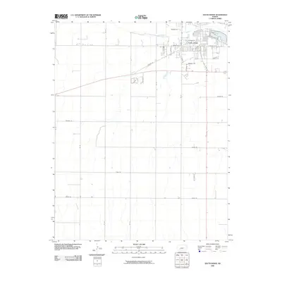
2009 Map of South Dodge
USGS Topo · Published 2009About this map
South Dodge anchors the northern portion of this map, situated where the high plains meet the riparian corridor of the Arkansas River. The settlement pattern shows a concentrated residential and commercial grid giving way to expansive rural sections defined by a precise network of section-line roads. This transition is marked by thoroughfares such as Mcartor Rd and W Beeson Rd, which bridge the gap between the suburban outskirts and the vast agricultural lands to the south.
Find a feature on this map
31 named features on this map. Tap any name to fly to it.
Don’t see what you’re looking for? This feature index may not catch every label — zoom into the map to look around manually.
Map Details
Editions of this 2009 South Dodge Map
This is the sole edition of this map. No revisions or reprints were ever made.
Other maps of this area

1892 · Dodge
USGS Topo · 1:125,000

1892 · Spearville
USGS Topo · 1:125,000

1894 · Spearville
USGS Topo · 1:125,000

1955 · Pratt
USGS Topo · 1:250,000

1955 · Dodge City
USGS Topo · 1:250,000

1958 · Dodge City
USGS Topo · 1:250,000

1959 · Pratt
USGS Topo · 1:250,000

1959 · Dodge City
USGS Topo · 1:250,000

1968 · Dodge City
USGS Topo · 1:24,000
1968 · Dodge City SW
USGS Topo · 1:24,000