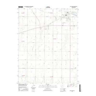
2016 Map of South Dodge
USGS Topo · Published 2016About this map
Arkansas River flows through the northern reaches of this Ford County landscape, defining the southern expansion of Dodge City. The 2016 survey illustrates the modern layout of South Dodge, where the street names like Longbranch Rd and Wilroads Garden Rd echo the region's cattle-driving heritage and early settlement history. While the northern section is densely organized into residential and commercial blocks, the terrain transitions quickly to the south into open plains marked by Section-line roads such as Matt Down Rd and Nickel Rd. To the southeast, Christ the King Cem stands near the edge of the rolling upland, while the far southern border is traced by the seasonal course of Mulberry Cr. This map reveals the juxtaposition between the historic core of the old West and the contemporary suburban and agricultural development of southwestern Kansas.
Find a feature on this map
54 named features on this map. Tap any name to fly to it.
Don’t see what you’re looking for? This feature index may not catch every label — zoom into the map to look around manually.
Map Details
Editions of this 2016 South Dodge Map
This is the sole edition of this map. No revisions or reprints were ever made.
Other maps of this area

1892 · Dodge
USGS Topo · 1:125,000

1892 · Spearville
USGS Topo · 1:125,000

1894 · Spearville
USGS Topo · 1:125,000

1955 · Pratt
USGS Topo · 1:250,000

1955 · Dodge City
USGS Topo · 1:250,000

1958 · Dodge City
USGS Topo · 1:250,000

1959 · Pratt
USGS Topo · 1:250,000

1959 · Dodge City
USGS Topo · 1:250,000

1968 · Dodge City
USGS Topo · 1:24,000
1968 · Dodge City SW
USGS Topo · 1:24,000