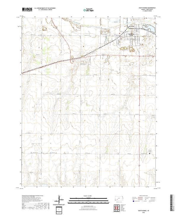
2022 Map of South Dodge
USGS Topo · Published 2022About this map
Dodge City and South Dodge occupy the northern reaches of this Ford County landscape, where the Arkansas River bends toward the southeast. The urban grid of the city gives way to a sprawling network of rural section roads, illustrating the transition from the historic cattle-town core to the agricultural plains. To the south, the terrain is defined by the winding course of Mulberry Cr, which cuts through the prairie landscape. Local history and genealogy are anchored by Christ the King Cem in the southeastern quadrant, a quiet landmark amidst the expansive road network. Transportation remains central to the area's layout, with major thoroughfares like Nickel Rd and Mcartor Rd connecting the rural townships of T27S and T28S to the commerce of the river valley.
Find a feature on this map
53 named features on this map. Tap any name to fly to it.
Don’t see what you’re looking for? This feature index may not catch every label — zoom into the map to look around manually.
Map Details
Editions of this 2022 South Dodge Map
This is the sole edition of this map. No revisions or reprints were ever made.
Other maps of this area

1892 · Dodge
USGS Topo · 1:125,000

1892 · Spearville
USGS Topo · 1:125,000

1894 · Spearville
USGS Topo · 1:125,000

1955 · Pratt
USGS Topo · 1:250,000

1955 · Dodge City
USGS Topo · 1:250,000

1958 · Dodge City
USGS Topo · 1:250,000

1959 · Pratt
USGS Topo · 1:250,000

1959 · Dodge City
USGS Topo · 1:250,000

1968 · Dodge City
USGS Topo · 1:24,000
1968 · Dodge City SW
USGS Topo · 1:24,000