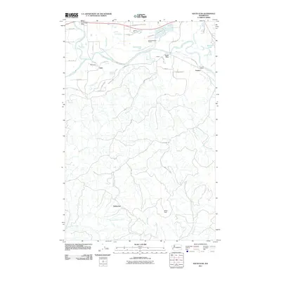
2011 Map of South Elma
USGS Topo · Published 2011About this map
The Chehalis River valley defines this region of Grays Harbor County, where the waterway meanders through a landscape marked by diverse transit and aviation hubs. Just south of the river, South Elma and Damon sit near the Elma Municipal Airport, while small airfields like My Airport and D and B Airpark are scattered among the settlements of Fuller and Saginaw. The northern edge is dominated by the Satsop River and the Satsop River Bridge, while the southern reaches rise toward the prominent Minot Peak.
Find a feature on this map
51 named features on this map. Tap any name to fly to it.
Don’t see what you’re looking for? This feature index may not catch every label — zoom into the map to look around manually.
Map Details
Editions of this 2011 South Elma Map
This is the sole edition of this map. No revisions or reprints were ever made.
Other maps of this area

1940 · Montesano
USGS Topo · 1:62,500

1941 · Mobray
USGS Topo · 1:62,500

1941 · Ford
USGS Topo · 1:62,500

1943 · Nahwatzel Lake
USGS Topo · 1:62,500

1943 · Mobray
USGS Topo · 1:62,500

1953 · Hoquiam
USGS Topo · 1:250,000

1953 · Malone
USGS Topo · 1:62,500

1953 · Elma
USGS Topo · 1:62,500

1955 · Montesano
USGS Topo · 1:62,500

1955 · Wynoochee Valley
USGS Topo · 1:62,500