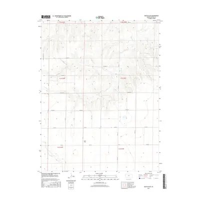
2015 Map of South Flats
USGS Topo · Published 2015About this map
South Flats occupies the southern reaches of this Wallace County landscape, where the High Plains terrain is etched by a series of intermittent watercourses. The drainage patterns of Rose Cr, N Fork Rose Cr, and Sand Cr create a network of draws and ridges across the northern sections, contrasting with the level expanses to the south. This 2015 survey reflects a rural infrastructure defined by a strictly surveyed grid of section lines and named thoroughfares. The presence of the Walker Landing Strip on the western edge suggests the importance of light aircraft in managing these large agricultural holdings. Local transport is facilitated by a network of descriptive roads, including Jackrabbit Rd, Ironhorse Rd, and Killdeer Rd, which provide access to the remote homesteads and fields that characterize this portion of Western Kansas.
Find a feature on this map
19 named features on this map. Tap any name to fly to it.
Don’t see what you’re looking for? This feature index may not catch every label — zoom into the map to look around manually.
Map Details
Editions of this 2015 South Flats Map
This is the sole edition of this map. No revisions or reprints were ever made.
Other maps of this area

1955 · Scott City
USGS Topo · 1:250,000

1958 · Scott City
USGS Topo · 1:250,000

1959 · Weskan
USGS Topo · 1:62,500

1959 · Wallace
USGS Topo · 1:62,500

1968 · Sharon Springs 3 NE
USGS Topo · 1:24,000

1968 · Sharon Springs 4 NW
USGS Topo · 1:24,000

1968 · Sharon Springs 4 NE
USGS Topo · 1:24,000
1979 · Wallace
USGS Topo · 1:24,000
1979 · Sharon Springs West
USGS Topo · 1:24,000
1979 · Spring Valley Ranch
USGS Topo · 1:24,000