Old Maps of Sharon Springs Township, Kansas
Explore 89 old maps of Sharon Springs Township, spanning from 1954 to today. These high-resolution historic maps reveal how streets, neighborhoods, landmarks, and natural features evolved over time — perfect for genealogy, metal detecting, research, and local history exploration.
What you can do with these maps:
- See how Sharon Springs Township changed over time: Compare historical maps to modern-day views to trace roads, homesites, rail lines & more.
- View detailed metadata: Each map includes creators, publishers, year, scale, and archive source.
- Overlay maps with satellite & LiDAR: Visualize the past alongside modern tools to explore terrain & human change.
- Trusted historical sources: Maps sourced from the USGS, Library of Congress, and other archives.
- Access maps your way: View online, download high-res files, or order prints for personal or research use.
Start exploring old maps of Sharon Springs Township to uncover forgotten places, hidden landmarks, and the deep history beneath your feet.
Sharon Springs Township, KS maps
(89)- 1954 Map of Goodland, 1976 Print
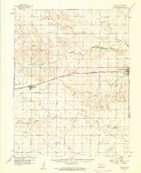
 1954 Goodland1976 Print · USGSNorthwest Kansas comes into focus during the mid-1950s, showing a landscape defined by its vital river forks and thriving rail towns. Researchers can trace the path of the Union Pacific through Colby or locate historic parks like Sheridan Co State Park.
 - 1955 Map of Scott City, 1969 Print
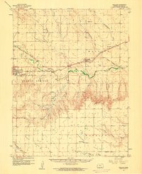
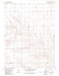
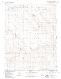
 1955 Scott City1969 Print · USGSWestern Kansas in the mid-fifties is captured here as a landscape of rural schoolhouses and significant rail corridors. Family historians can trace the locations of Skyline and Beaver Creek Schools or follow the Union Pacific line through Oakley and Sharon Springs.4 unique versions available
 - 1956 Map of Goodland
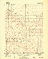
 1956 Goodland1956 Print · USGSThe high plains of Northwest Kansas in the mid-fifties reveal a landscape of river-fed agriculture and expanding rail networks. Genealogists and historians can trace the development of county seats like Goodland and Atwood or locate landmarks such as the Arikaree Breaks.
 - 1957 Map of Goodland
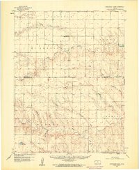
 1957 Goodland1957 Print · USGSNorthwest Kansas in the mid-1950s shows a landscape of high plains agriculture and vital rail junctions. Researchers can trace the river-valley settlements from Goodland to Oberlin and follow the paths of the Union Pacific and Sappa Creek.2 unique versions available
 - 1958 Map of Scott City
 1958 Scott City1958 Print · USGSWestern Kansas at the peak of the post-war era reveals a landscape of high-plains agriculture and vital rail junctions. Genealogists and historians can trace old country school sites like Prairie Bell School, the landmark Chalk Pyramids, and small stops along the Union Pacific and Missouri Pacific.
 - 1959 Map of Weskan, 1960 Print
 1959 Weskan1960 Print · USGSWallace County in the late 1950s was a land of railroad sidings and river breaks, centered on the Union Pacific line. Genealogists and historians can trace local landmarks like Weskan Cem, the water at Old Maid Pool, and the siding of Sunland.
 - 1959 Map of Wallace, 1960 Print
 1959 Wallace1960 Print · USGSWallace County in the late fifties was defined by its railroad heritage and the deep drainage of the Smoky Hill River. You can trace the Union Pacific line from Sharon Springs to Wallace, locating landmarks like the Dinas Ch, Wallace Cem, and Big Lagoon.
 - 1959 Map of Harris Draw, 1960 Print
 1959 Harris Draw1960 Print · USGSThe High Plains of Western Kansas are captured here during the late fifties, showing the rural landscape along the Sherman Co and Wallace Co border. Local historians can trace early community sites like Mound School, Mt Pleasant School, and the Mennonite Cemetery.
 - 1959 Map of Horsethief Draw, 1960 Print
 1959 Horsethief Draw1960 Print · USGSThe high plains of Wallace County are captured in the late 1950s as a landscape of deep draws and seasonal rivers. Genealogists and local historians can locate rural landmarks such as Sandy Hill Sch, Fairview Cem, and the notable Horsethief Cave.2 unique versions available
 - 1968 Map of Sharon Springs 3 NE, 1969 Print
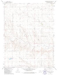
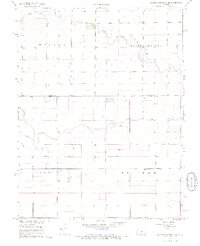 1968 Sharon Springs 3 NE1969 Print · USGSWestern Kansas ranching and farm lands are captured here in the late sixties, where the high plains meet the Colorado border. Researchers can trace land use through a network of water sources including South Ladder Creek and numerous Well sites across Colony and Weskan.2 unique versions available
 - 1968 Map of Sharon Springs 4 NW, 1969 Print
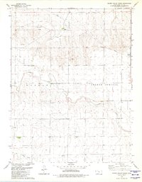
 1968 Sharon Springs 4 NW1969 Print · USGSWestern Kansas high plains and the winding branches of the local creek system are captured here in the late sixties. Researchers can trace the Bethany Cem and the complex confluence of Middle Ladder Creek and Sharon Springs Creek.2 unique versions available
 - 1979 Map of Horsethief Draw NW, 1980 Print
 1979 Horsethief Draw NW1980 Print · USGSSherman and Wallace counties are captured in the late seventies, showing a landscape defined by the High Plains river system. Genealogists and land researchers can locate specific sites like Turtle Creek Lake, Sappa Creek, and various Gravel Pits along the county line.
 - 1979 Map of Sharon Springs West, 1980 Print
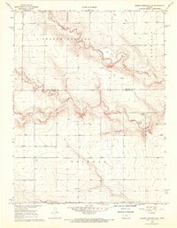
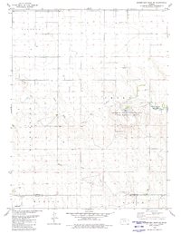
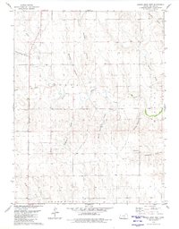
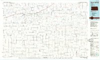
 1979 Sharon Springs West1980 Print · USGSWestern Kansas at the close of the 1970s shows a prairie landscape deeply tied to the Smoky Hill River and the railroad. Genealogists and local historians can trace the development of Sharon Springs through its original Union Pacific tracks, Lakeview Park, and Sharon Springs Cem.
 - 1979 Map of Horsethief Draw, 1980 Print
 1979 Horsethief Draw1980 Print · USGSWallace County high plains are captured here in the late seventies, showing a landscape defined by deep draws and canyons. Researchers can trace land use through features like Horsethief Cave, a lone Grave, and the winding Salt Grass Canyon.
 - 1979 Map of Spring Valley Ranch, 1980 Print
 1979 Spring Valley Ranch1980 Print · USGSWallace County ranching and water management are front and center in this late-seventies survey of the High Plains. Genealogists and local historians can locate Spring Valley Ranch and the Dover Grange Hall or trace the winding paths of Ladder Creek.
 - 1979 Map of Horsethief Draw NE, 1980 Print
 1979 Horsethief Draw NE1980 Print · USGSSherman County at the close of the 1970s reveals a landscape defined by the confluence of the North Fork Smoky Hill River and Smoky Hill River. Researchers can trace the layout of the Sherman State Fishing Lake and Wildlife Area or locate the Fairview Cem and Soldiers Memorial County Park.
 - 1979 Map of Sharon Springs East, 1980 Print
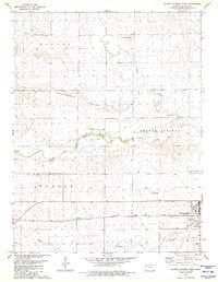
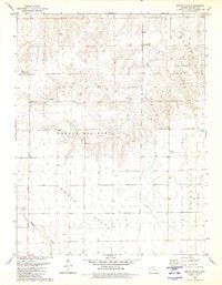
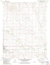 1979 Sharon Springs East1980 Print · USGSSharon Springs and the High Plains come into sharp focus in the late seventies, centered on the railroad-and-river corridor. Researchers can trace the path of the Union Pacific through town or locate the Sharon Springs Cem and Gravel Pits along the Smoky Hill River.
 - 1979 Map of Wild Horse Draw, 1980 Print
 1979 Wild Horse Draw1980 Print · USGSSherman and Wallace counties are shown in the late 1970s, focused on the high plains drainage systems. Researchers can trace the winding North Fork Smoky Hill River and locate historic land-use sites like the local Gravel Pits and Wild Horse Draw.
 - 1979 Map of Harris Draw West, 1980 Print
 1979 Harris Draw West1980 Print · USGSWallace County was a landscape of deep canyons and seasonal draws in the late seventies. Genealogists and historians can trace the paths of Blindman Canyon and Wildcat Canyon, or locate isolated landmarks like Big Spring and a lonely Grave.
 - 1979 Map of South Flats, 1980 Print
 1979 South Flats1980 Print · USGSWallace County, Kansas, is documented here in the late seventies during a period of steady agricultural use. Researchers can trace the section lines across South Flats or locate landmarks like the Walker Landing Strip and Rose Creek.
 - 1979 Map of Weskan NW, 1980 Print
 1979 Weskan NW1980 Print · USGSThe High Plains of Wallace County are captured here in the late seventies, showing the vital corridors of the Smoky Hill River and the Union Pacific railroad. Researchers can trace land divisions in Weskan and Morton or locate landmarks like Rattlesnake Gulch.
 - 1979 Map of Horsethief Draw SE, 1980 Print
 1979 Horsethief Draw SE1980 Print · USGSWestern Kansas at the close of the seventies reveals a landscape defined by the branching waters of North Fork Lake Creek. Researchers can trace old township lines in Morton and locate the McKinley Cem among the draws and gravel works.
 - 1985 Map of Goodland
 1985 Goodland1985 Print · USGSSherman and Thomas counties appear in the mid-1980s as a vital transportation and agricultural corridor across the Kansas High Plains. Researchers can trace the rail-side growth of Ruleton, Edson, and Levant or locate landmarks like Colby Jr College and Soldiers Memorial County Park.2 unique versions available
 - 1985 Map of Sharon Springs
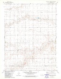
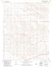
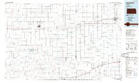
 1985 Sharon Springs1985 Print · USGSWestern Kansas at the mid-eighties reveals a landscape shaped by the Union Pacific and the historic Butterfield Overland Trail. Researchers can trace the frontier legacy of the Fort Wallace (site) and explore rural landmarks from Weskan to Russell Springs.2 unique versions available
 - 2009 Map of Horsethief Draw NE, 2009 Print
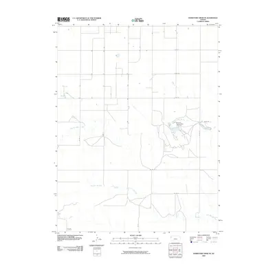 2009 Horsethief Draw NE2009 Print · USGSCovers Sharon Springs Township, including Wallace County, Sherman County, and other nearby areas
Showing maps 1-25 of 89
Top cities near Sharon Springs Township
Top neighborhoods of Sharon Springs Township
Frequently asked questions
- What are the different types of historical maps available for Sharon Springs Township?
- What is the oldest map of Sharon Springs Township?
- Where can I purchase historical maps of Sharon Springs Township for my home or office?
- Where can I download high-res historical maps of Sharon Springs Township?
- Are there historical topographic maps available for Sharon Springs Township?
- Is there historical aerial imagery available for Sharon Springs Township?
- Where are historical maps of Sharon Springs Township sourced from?