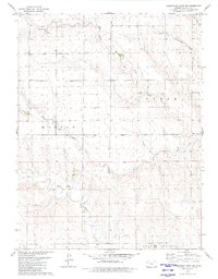
1979 Map of Horsethief Draw SE
USGS Topo · Published 1980About this map
The high plains of Wallace County are defined here by the intricate drainage systems of North Fork Lake Creek, Middle Fork Lake Creek, and South Fork Lake Creek. This 1979 survey records a landscape shaped by intermittent water and early industry, featuring scattered Well sites and Gravel Pits concentrated near the northern boundary. The township lines of Morton and Sharon Springs anchor the survey, showing a sparse settlement pattern characteristic of the western Kansas prairie. Genealogists and local historians will find the McKinley Cem positioned in the eastern portion of the sheet, while the winding paths of Goose Creek and Armstrong Draw illustrate the natural topography that dictated cattle ranching and homesteading routes across this section of the High Plains.
Find a feature on this map
10 named features on this map. Tap any name to fly to it.
Don’t see what you’re looking for? This feature index may not catch every label — zoom into the map to look around manually.
Map Details
Editions of this 1979 Horsethief Draw SE Map
This is the sole edition of this map. No revisions or reprints were ever made.
Other maps of this area

1954 · Goodland
USGS Topo · 1:250,000

1955 · Scott City
USGS Topo · 1:250,000

1956 · Goodland
USGS Topo · 1:250,000

1957 · Goodland
USGS Topo · 1:250,000

1958 · Scott City
USGS Topo · 1:250,000

1959 · Weskan
USGS Topo · 1:62,500

1959 · Wallace
USGS Topo · 1:62,500

1959 · Harris Draw
USGS Topo · 1:62,500

1959 · Horsethief Draw
USGS Topo · 1:62,500
1979 · Horsethief Draw NW
USGS Topo · 1:24,000