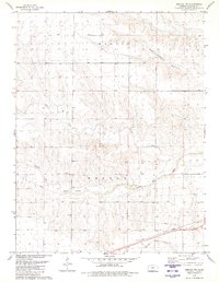
1979 Map of Weskan NW
USGS Topo · Published 1980About this map
The Smoky Hill River cuts through this Western Kansas landscape, defining the drainage patterns of Wallace County during the late 1970s. The terrain is marked by a series of intermittent watercourses including Willow Creek and the strikingly named Rattlesnake Gulch to the north, which feed into the primary river valley. These features illustrate the natural hydrology of the High Plains before reaching more populated regions to the east.
Find a feature on this map
10 named features on this map. Tap any name to fly to it.
Don’t see what you’re looking for? This feature index may not catch every label — zoom into the map to look around manually.
Map Details
Editions of this 1979 Weskan NW Map
This is the sole edition of this map. No revisions or reprints were ever made.
Other maps of this area

1892 · Cheyenne Wells
USGS Topo · 1:125,000

1894 · Cheyenne Wells
USGS Topo · 1:125,000

1954 · Limon
USGS Topo · 1:250,000

1954 · Lamar
USGS Topo · 1:250,000

1954 · Goodland
USGS Topo · 1:250,000

1955 · Scott City
USGS Topo · 1:250,000

1956 · Goodland
USGS Topo · 1:250,000

1957 · Limon
USGS Topo · 1:250,000

1957 · Goodland
USGS Topo · 1:250,000

1958 · Limon
USGS Topo · 1:250,000