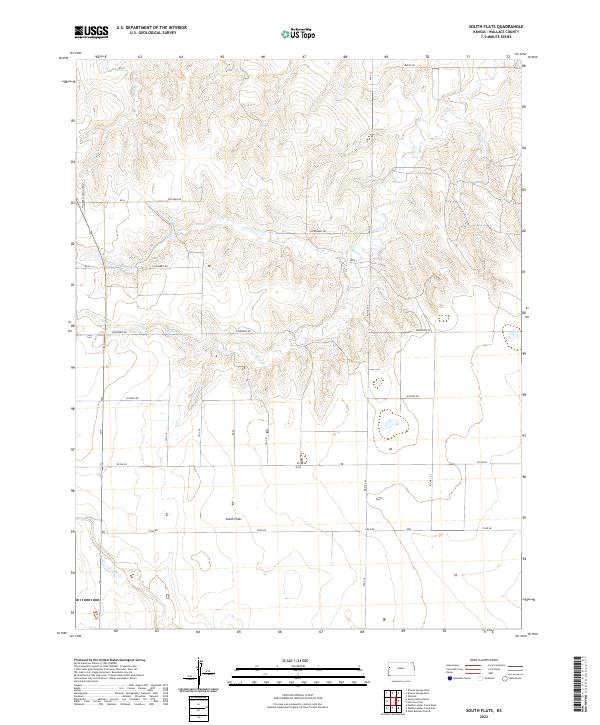
2022 Map of South Flats
USGS Topo · Published 2022About this map
South Flats centers this western Kansas landscape, where the High Plains are deeply dissected by the ephemeral drainage systems of the Smoky Hill River watershed. The terrain is defined by the winding paths of N Fork Rose Cr, Rose Cr, and Sand Cr, which have carved intricate coulees into the plateau. This 2022 survey illustrates a classic section-line road network designed for large-scale agricultural operations, with named corridors like Jackrabbit Rd and Ironhorse Rd providing the primary access through the townships. A notable feature of this rural infrastructure is the Walker Landing Strip on the western edge, reflecting the integration of aviation into modern ranching and farming practices. The map details the transition from the flat tablelands to the more complex topography surrounding the creek breaks.
Find a feature on this map
19 named features on this map. Tap any name to fly to it.
Don’t see what you’re looking for? This feature index may not catch every label — zoom into the map to look around manually.
Map Details
Editions of this 2022 South Flats Map
This is the sole edition of this map. No revisions or reprints were ever made.
Other maps of this area

1955 · Scott City
USGS Topo · 1:250,000

1958 · Scott City
USGS Topo · 1:250,000

1959 · Weskan
USGS Topo · 1:62,500

1959 · Wallace
USGS Topo · 1:62,500

1968 · Sharon Springs 3 NE
USGS Topo · 1:24,000

1968 · Sharon Springs 4 NW
USGS Topo · 1:24,000

1968 · Sharon Springs 4 NE
USGS Topo · 1:24,000
1979 · Wallace
USGS Topo · 1:24,000
1979 · Sharon Springs West
USGS Topo · 1:24,000
1979 · Spring Valley Ranch
USGS Topo · 1:24,000