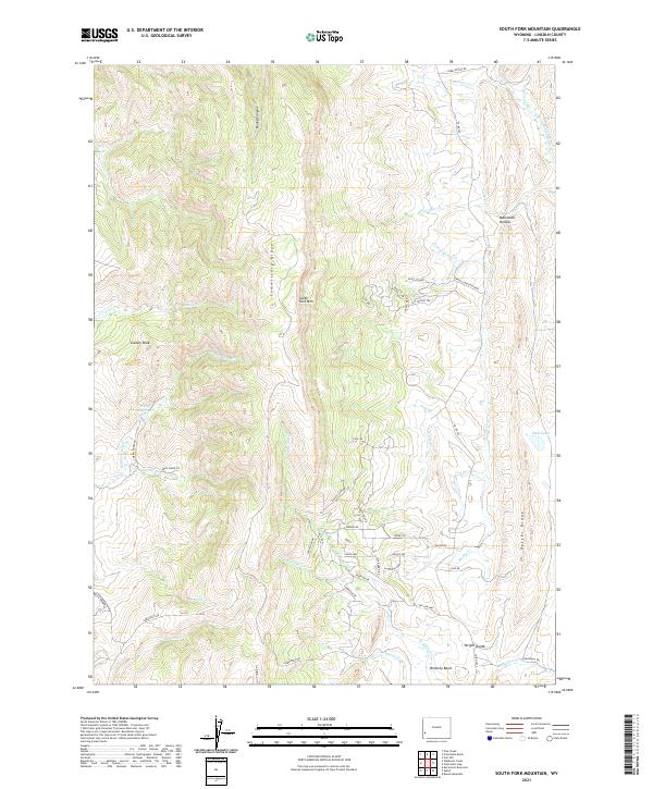
2021 Map of South Fork Mountain
USGS Topo · Published 2021About this map
South Fork Mountain and the high ridges of Lincoln County define this landscape along the eastern edge of the Overthrust Belt. The map reveals a high-altitude terrain marked by the prominent north-south spine of Commissary Ridge and the western slopes of Oyster Ridge. Water management in this arid environment is evident through features like the Philip Reservoir and various seasonal drainages such as Sheep Dip Creek and Beaver Dam Creek. A notable historical trace appears in the southeast corner with the Emigrant Trail, crossing through the Pomeroy Basin near the Wright Divide. This corridor highlights the region's importance for transcontinental travel long before the development of local ranching infrastructure like the Spring Canyon Ranch and the network of access roads serving the interior canyons.
Find a feature on this map
62 named features on this map. Tap any name to fly to it.
Don’t see what you’re looking for? This feature index may not catch every label — zoom into the map to look around manually.
Map Details
Editions of this 2021 South Fork Mountain Map
This is the sole edition of this map. No revisions or reprints were ever made.
Other maps of this area

1936 · Cokeville
USGS Topo · 1:96,000

1942 · Cokeville
USGS Topo · 1:125,000

1945 · Fort Hill
USGS Topo · 1:62,500

1947 · Fort Hill
USGS Topo · 1:62,500

1954 · Ogden
USGS Topo · 1:250,000

1954 · Kemmerer
USGS Topo · 1:62,500

1955 · Preston
USGS Topo · 1:250,000

1958 · Ogden
USGS Topo · 1:250,000

1958 · Preston
USGS Topo · 1:250,000

1960 · Ogden
USGS Topo · 1:250,000